Kimberley Wildfire Evacuation Alert: Wind Holds the Key for B.C. Town
Text Here
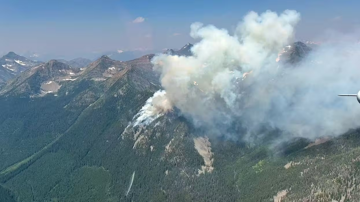
A Kimberley wildfire evacuation alert is now in effect for more than 8,000 residents in British Columbia. The Matthew Creek fire is burning roughly 10 kilometres west of the town, near the Alberta boundary. Officials say the outcome now depends heavily on the weather. Mayor Don McCormick admits the town’s fate rests largely on the wind.
“The B.C. Wildfire Service is getting (its) plan together on how they intend to attack the fire, and really the thing that we’re most concerned about right now is the wind — what direction and, you know, how strong will the winds be,” McCormick said.
“And as long as the wind stays down, things are good. The wind comes back up again. It could get a little bit unpredictable.”
The fire is one of about 180 blazes that ignited within just a few days after storms swept across the province. Lightning strikes numbered 33,380 during that period. Consequently, crews across British Columbia are stretched thin as they respond to multiple fronts at once.
Firefighters Race Against Unpredictable Winds
The BC Wildfire Service has listed the Matthew Creek fire as one of four “wildfires of note” in the province. This designation means the blaze threatens public safety and critical infrastructure or is highly visible from surrounding communities. As a result, the fire is receiving priority attention from provincial crews.
Senior wildfire officer Jeremy Angus explained the strategy during a briefing on Monday. Firefighters plan to use heavy machinery to build containment lines between the fire and Kimberley. If that fails, crews will fell trees and burn along a road in what Angus calls a “last-ditch effort.”
The fire currently spans nearly six square kilometres. Light winds on Monday reduced its behaviour somewhat, giving crews a temporary advantage. Thick smoke from the fire may also be helping to suppress its spread.
“Hopefully we stay a little bit socked in with smoke to keep that fire activity down until we can get containment,” Angus added.
For now, conditions in Kimberley remain manageable. McCormick said the wind “seems to be blowing in a great direction” and the air in the town is “pretty clear.” Meanwhile, more than 8,000 residents remain on standby, ready to leave at a moment’s notice according to the Regional District of East Kootenay.
Sarah Schultz, manager of Top Crop Too, a local garden and farm supply store, said the fire sits about 14 kilometres from her location. She considers this “a safe distance” for now. Additionally, Schultz noted that her area isn’t especially smoky, since the wind has been working in the community’s favour.
This isn’t the first time Kimberley has faced this kind of threat. McCormick said the town issued a similar alert back in 2018 due to another wildfire. That earlier experience, which lasted three weeks, ultimately helped shape the town’s current emergency response.
“And the experience that we received from that three weeks and the follow-on from that enabled us to update all of our policies and emergency service,” he said. The Matthew Creek fire was first discovered on Saturday and is believed to have been sparked by lightning.
More Than 90 Wildfires Burning Across B.C.
British Columbia’s wildfire situation has escalated quickly. More than 90 active fires burned across the province as of Monday evening. That number represents a sharp jump from roughly 20 fires just a week earlier, highlighting how fast conditions can change.
The Kimberley-area fire isn’t the only concern for residents this week. Hundreds of properties remain evacuated or under alert in the Boston Bar area of the Fraser Canyon, where two separate wildfires continue to burn. Therefore, emergency crews are managing multiple regions simultaneously.
Further north, the Thompson-Nicola Regional District issued an evacuation order for Downing Provincial Park. This area sits about 18 kilometres southwest of Clinton. The order came in direct response to the Pear Lake wildfire, which is also threatening nearby communities.
That same fire triggered an evacuation alert for roughly 38 properties in the Bonaparte Plateau area. This region lies about 55 kilometres northwest of Kamloops. Clearly, wildfire activity is no longer confined to a single corner of the province.
Air Quality Warnings Spread Across the Province
Smoke from these fires is affecting air quality well beyond the immediate fire zones. Environment Canada has issued warnings for several locations, stretching from Fort Nelson in the north to Prince George in central B.C. The Fraser Canyon and the province’s southeast corner, where the Kimberley wildfire evacuation alert remains active, are also included.
Metro Vancouver Regional District issued its own yellow air quality warning for the Eastern Fraser Valley. This covers communities including Chilliwack, Agassiz, and Hope. Elevated fine particulate matter from wildfire smoke is behind the warning, which officials say poses a high health risk.
Consequently, health authorities are urging residents in affected areas to limit outdoor activity until conditions improve. The BC Wildfire Service expects smoky skies to persist across much of the province in the coming days. Conditions may even worsen in the northeastern and central regions.
For Kimberley, however, the immediate focus remains squarely on wind direction. Crews continue building containment lines while residents wait for updates. As McCormick noted, calm winds offer the best chance of protecting the town, but conditions could shift quickly if the wind picks up again.
This report by The Canadian Press was first published July 20, 2026, with files by Chuck Chiang in Vancouver.