Extreme Heat Warnings: Cities Could Feel Like 45°C
Environment Canada has issued extreme heat warnings for large parts of Ontario, Manitoba and Quebec. Humidex values in several cities could climb as high as 45, forcing residents to take precautions. The alerts cover a wide stretch of the country, and forecasters say Tuesday will bring the worst of the heat.
Meanwhile, northern communities are not escaping the misery either. From Thunder Bay to Fort Simpson, the extreme heat warnings stretch across provincial and territorial lines. Health officials are urging people to stay cool, hydrated, and indoors during peak hours.
Ontario Cities Brace for Scorching Heat and Humidity
Ottawa and Toronto are expected to hit a maximum of 38 C on Tuesday. However, with humidity factored in, the humidex could push that number up to a blistering 45. As a result, outdoor activity during the afternoon poses real health risks for vulnerable residents.
Other Ontario cities are not far behind. Hamilton, London and Windsor will also see scorching conditions throughout the day. Similarly, northern cities like Thunder Bay and Kenora will face temperatures near 35 C, feeling closer to 40 with the added humidity.
Environment Canada did not mince words in its warning. “Today will mark the peak of this heat event,” the agency said. It added, “Take action to protect yourself and others – extreme heat can affect everyone’s health.”
This heat wave follows an already brutal Monday. According to The Weather Network, Armstrong in northwestern Ontario reached 40.7 C — the hottest temperature the province has recorded in 90 years. Consequently, meteorologists are watching closely for more records to fall.
Tuesday could bring another milestone. Toronto’s hottest July 14 on record dates back to 1995, when the mercury hit 36.8 C, according to CP24 Weather Specialist Jess Smith. Therefore, this week’s numbers may rewrite the city’s weather history books.
There is some relief on the horizon, though not immediately. Central and northeastern Ontario should cool down Tuesday night. In southern Ontario, however, the high heat is expected to linger until Wednesday or Thursday before conditions ease.
Environment Canada’s alert map reflects the scale of this event. Yellow alerts signal hazardous weather that may cause damage, disruption, or health impacts. Orange alerts, on the other hand, warn of severe weather likely to cause significant harm across affected regions.
Heat Warnings Spread Across Manitoba, Quebec and the Northwest Territories
Northern Manitoba is also under an active heat warning. Communities such as Norway House and Flin Flon could see highs of 29 C on Tuesday. Unlike Ontario, this heat is expected to persist into Wednesday before finally breaking.
Western Quebec is facing similarly intense conditions. Areas including Matagami, Wakefield, Rouyn and Gatineau may reach 37 C, with humidex values touching 45. Fortunately, temperatures and humidity should begin dropping overnight Tuesday across the province.
Quebec’s weather troubles do not end with the heat alone. Meteorologists are also tracking a severe thunderstorm system near Shawinigan and Trois-Rivières. This storm carries the potential for damaging wind gusts and sudden, heavy downpours.
Consequently, utility outages are a real possibility in these areas. Heavy rain can trigger flash flooding and sharply reduce visibility for drivers. Residents in these regions should stay alert to changing conditions throughout the evening.
Further north, the Northwest Territories are dealing with their own heat challenge. Fort Simpson and Hay River are expected to approach 30 C during the day. While nights should offer some relief, daytime heat is forecast to last through the weekend.
Wildfire Smoke Raises Air Quality Concerns
Extreme heat rarely travels alone, and this event is no exception. Wildfire activity is compounding the problem, degrading air quality across Manitoba, Ontario and the Northwest Territories. Consequently, health risks are rising even in areas outside the direct heat warnings.
Environment Canada addressed the smoke risk directly in its statement. “Smoke from wildfires is causing poor air quality and reduced visibility,” the agency cautioned. It continued, “As smoke levels increase, health risks increase. Limit time outdoors. Consider reducing or rescheduling outdoor sports, activities and events.”
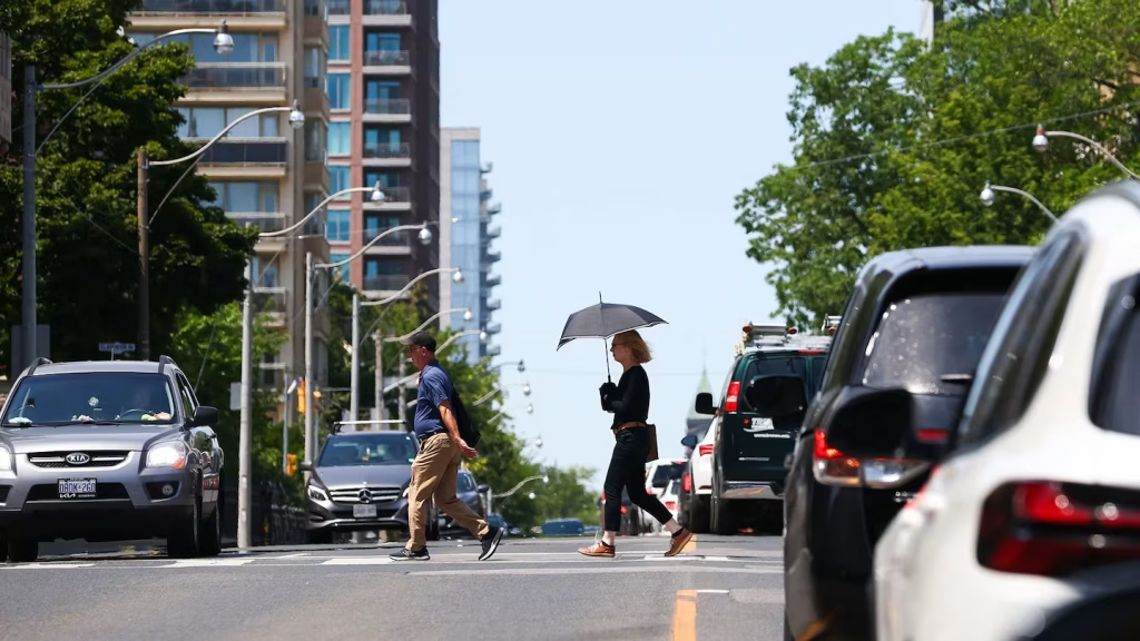
City streets reflect the strain of this dual threat. In midtown Toronto, pedestrians crossed busy intersections Tuesday under a hazy, sweltering sky. Photos from the scene show just how tangible this heat wave has become for everyday commuters.
Even cities without heavy wildfire smoke are seeing worse air quality. According to IQAir, which tracks pollution data from major cities worldwide, Montreal currently ranks 56th globally for air pollution. Toronto sits at 59th, while Vancouver lands further down the list at 117th.
Taken together, the heat and smoke create a challenging combination for millions of Canadians this week. Experts recommend limiting outdoor exposure, staying hydrated, and checking on elderly or vulnerable neighbours. As temperatures ease later in the week, air quality is also expected to gradually improve.